Sea ice extent becoming a climate-change barometer …
The National Snow and Ice Data Center last week issued its annual declaration on how much the north polar ice cap has shrunk over the preceding six months of spring and summer – the so-called minimum Arctic sea-ice extent, designating a point in mid-September at which the ice has ceased to recede and is likely to begin growing again as cooler fall weather sets in.
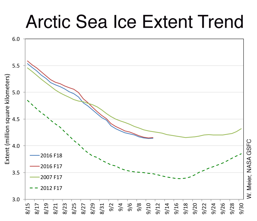
“It’s tied with 2007 as the second-lowest (extent),” says Julienne Stroeve, a senior research scientist with the Snow and Ice Data Center. (See editor's note, below) The Colorado-based organization last week declared this year’s minimum extent was preliminarily estimated at 1.6 million square miles, about the same as 2007’s – and second only to 2012’s minimum of about 1.3 million square miles. That’s about the size of two Alaskas.

Stroeve says this year’s minimum reflects a trend scientists have been monitoring with satellites since 1979.
“Basically, the 10 lowest have all occurred in the last 10 years,” she said. “And when you look at what’s happening with Arctic sea ice, this is a long-term trend that we’re seeing, and we’re on that trajectory of having an Arctic that’s ice-free in summers.”
Communicating the complexities of climate change to the general public can be difficult. And Stroeve says reporting on the shrinking polar ice cap is a good way to help people understand what’s happening.
“It’s a very clear sign of the sort of climate change that we’re seeing,” she said.
Lawson Brigham, a distinguished professor of geography and Arctic policy with the University of Alaska Fairbanks, agrees.

“This is a benchmark kind of thing, this minimum, which gets a lot of global press, and it correlates directly with global climate change,” Brigham said in an interview last week. “So, it’s a good thing.”
He says sea-ice extent is only one of many climate-change impacts, but he agrees reporting on it is an effective way to help people understand how those impacts are affecting the Arctic.
“It’s one of many,” he said. “But when you hear about the methane release and the permafrost changes and when you collectively add them all up, you see great change.”
Brigham’s a retired career Coast Guard officer who spent many years in the Arctic commanding cutters and other vessels. He hopes keeping people informed about the diminishing sea-ice extent will help them understand humanity’s role in what’s causing it – the continued production of greenhouse gases.
Editor's note: The National Snow and Ice Data Center this week posted an addendum stating that the minimum sea-ice extent declared last week is a preliminary announcement. "Changing winds or late-season melt could still reduce the Arctic ice extent, as happened in 2005 and 2010," the note stated. "NSIDC scientists will release a full analysis of the Arctic melt season, and discuss the Antarctic winter sea ice growth, in early October."


